TL;DR:
- Even experienced hikers frequently make navigation mistakes leading to search and rescue incidents.
- Wilderness navigation involves terrain reading, map interpretation, compass use, and continuous situational awareness.
- Building good habits and practicing layered skills are essential, as tools support but do not replace awareness.
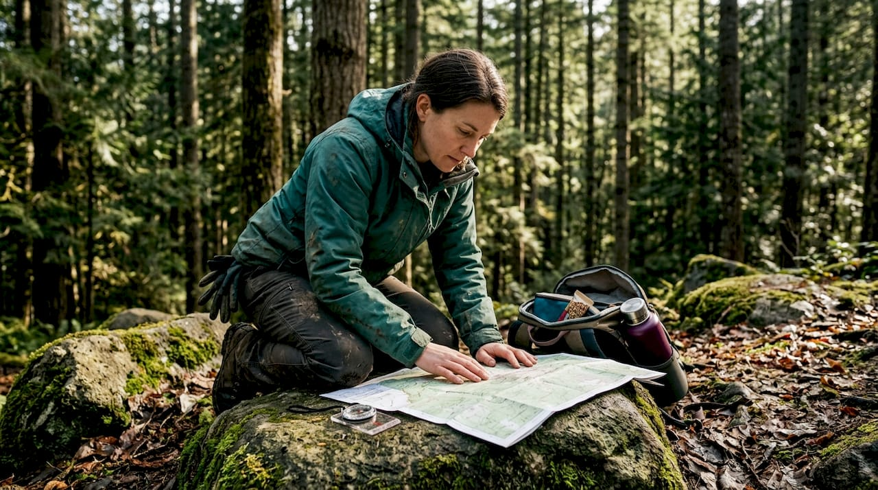
Getting lost in the wilderness is more common than most people think, and it happens to experienced hikers just as often as beginners. Navigation errors contribute to over 2,000 incidents in U.S. National Parks every single year, with roughly 70% of those situations involving people who wandered off established trails. Whether you're heading into the backcountry for the first time or you've been camping for years, understanding real wilderness navigation is what separates a great adventure from a dangerous one. This article breaks down the essential skills, tools, and mindset you need to explore nature with confidence.
Key Takeaways
| Point | Details |
|---|---|
| Navigation saves lives | Most lost hiker rescues stem from navigation errors that are avoidable with proper skills. |
| Terrain reading comes first | Learning to interpret and track the landscape is essential before using maps or technology. |
| Use multiple methods | Relying on map, compass, and GPS together provides the strongest safety net in the wild. |
| Mental habits matter most | Staying aware and checking your position regularly prevent costly mistakes outdoors. |
| Anyone can learn | With practice, wilderness navigation skills are accessible for both beginners and seasoned adventurers. |
Why wilderness navigation matters: Risks and realities
Most people assume they won't get lost because they have a smartphone with GPS. That assumption gets people into serious trouble every year. Phone batteries die. Signals drop in canyons and dense forests. Apps crash. And when any of that happens without a backup plan, a fun hike turns into a search and rescue operation.
Navigation errors drive over 2,000 annual U.S. National Park incidents, with 70% involving off-trail situations where landmarks vanish and trails are nowhere in sight. These aren't just beginners either. Fit, experienced hikers with decent gear make navigation mistakes regularly, especially when they've leaned too hard on one tool or skipped basic awareness habits.
Here's what tends to go wrong:
- Relying entirely on a phone app without downloading offline maps
- Moving too fast through unfamiliar terrain without checking position
- Ignoring visual landmarks like ridgelines, streams, and rock formations
- Failing to track how far they've traveled or in which direction
- Not carrying a physical map or compass as a backup
"The wilderness doesn't care how many times you've camped before. It rewards attention and punishes assumptions."
Understanding navigation matters for camping safety is the first step toward becoming a self-sufficient outdoorsperson. Digital tools are helpful, but they are supporting characters, not the hero of your navigation story. Skills are the hero. Anyone heading into the backcountry should treat navigation as a core competency, not an afterthought. For a broader introduction to remote terrain travel, the backcountry hiking guide at Life Camp Adventure is a strong place to start.
Now that we've set the stage with the real-world stakes, let's define what wilderness navigation actually involves.
Defining wilderness navigation: More than following a map
People often use the word "navigation" to mean checking a map or following trail markers. Real wilderness navigation is a much bigger picture. It means actively reading your environment, making judgment calls, and keeping yourself oriented even when no trail exists and no signal reaches your phone.
As defined by outdoor education experts, wilderness navigation is the set of skills and techniques used to find one's way in remote, unmarked outdoor terrain without relying solely on trails or modern technology. That definition matters because it shifts the focus from tools to thinking. The tools serve you. Your brain runs the operation.
The wilderness navigation toolkit includes several overlapping layers:
- Terrain reading: Recognizing how the land shapes around you, using ridges, drainages, and slopes to stay oriented
- Topographic maps: Interpreting contour lines to understand elevation changes before you walk into them
- Compass work: Taking bearings and following a direction even when landmarks aren't visible
- GPS as redundancy: Using satellite navigation to confirm your position, not to replace your awareness
- Mental mapping: Building a picture of your route in your head so you can backtrack if needed
"Staying found is an active choice, not a passive state. You have to choose to pay attention, every few minutes, throughout the whole trip."
The key insight here is that wilderness navigation is a process, not a one-time skill you check off a list. Mastering maps for safety is one piece of the puzzle, but it only works when combined with terrain awareness and a habit of continuous checking. Learning these essential outdoor navigation skills builds a foundation that works whether or not your battery is charged.
With a clear understanding of what wilderness navigation is, the next question is: What are the most crucial skills, and how do you learn them?
Core skills for wilderness navigation: Step-by-step essentials
Learning wilderness navigation feels overwhelming at first, but it follows a clean, logical progression. Start simple, add layers, and practice every time you're outdoors, even on easy trails.
Here's the order that makes the most sense for building real competence:
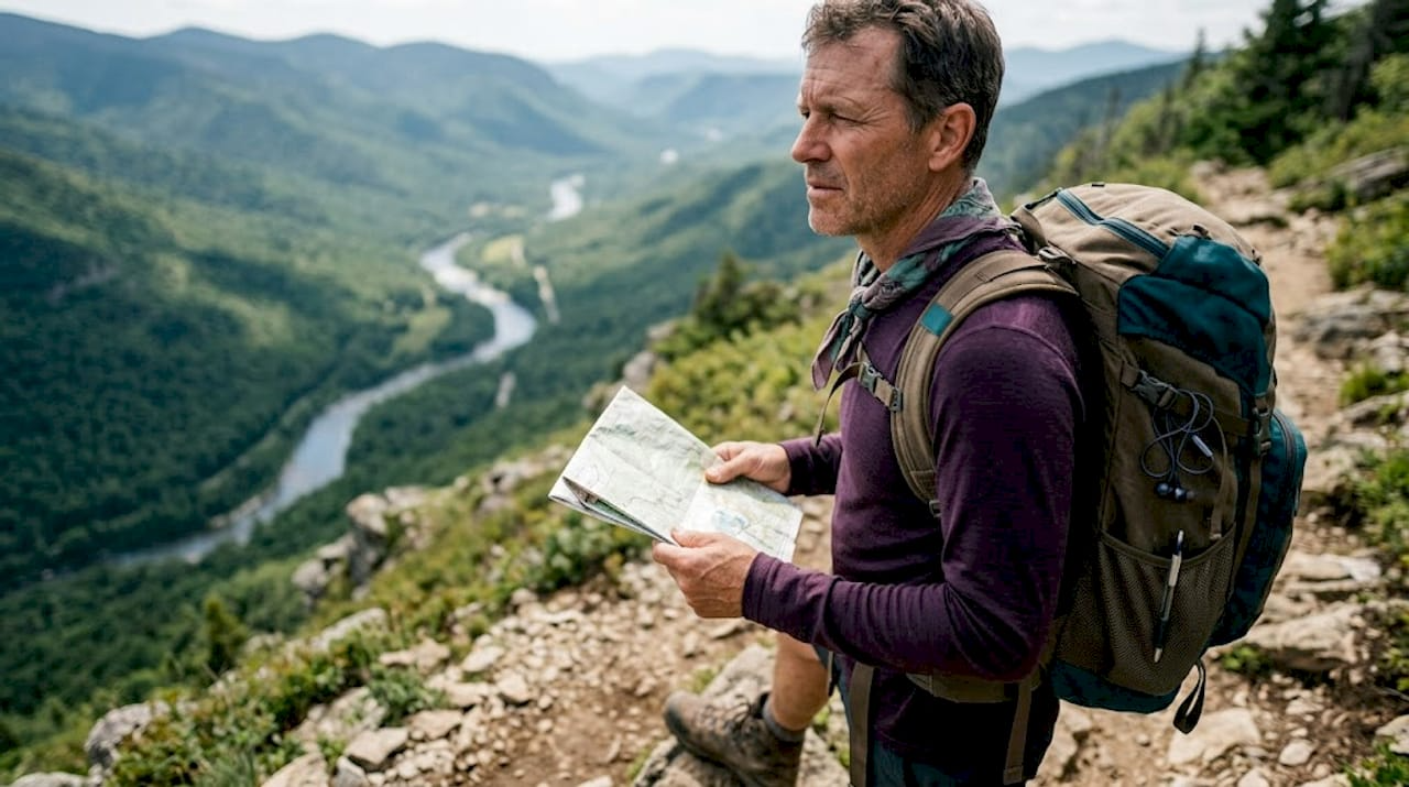
- Learn to read terrain. Before picking up a compass or opening a map app, train your eyes. Notice slope direction, water flow, and how ridgelines connect. This is your primary navigation tool when everything else fails.
- Study topographic maps. Learn what contour lines tell you about elevation. A cluster of tight lines means a steep slope. Wide spacing means gradual terrain. Practice correlating what you see on the map with what you see around you.
- Practice compass basics. Learn to take a bearing from a map and walk that bearing on the ground. Practice triangulating your position using two or three landmarks.
- Add GPS as a check. Once you trust your terrain reading and compass skills, use GPS to confirm your position, not replace your awareness. The reliability of GPS outdoors depends heavily on terrain, tree cover, and battery life.
- Simulate getting turned around. With a partner nearby, practice recovering from a deliberately disoriented position. This builds the calm, methodical thinking you'll need if it ever happens for real.
According to NOLS wilderness navigation training, experts prioritize "staying found" through constant terrain reading over any single tool, and they recommend learning sequentially: terrain first, then compass and map, GPS last. Redundancy across methods beats relying on any one approach.
| Skill level | Primary tool | Backup tool | Practice setting |
|---|---|---|---|
| Beginner | Marked trails | Phone GPS | Day hikes near home |
| Intermediate | Topographic map | Compass | Off-trail scrambles |
| Advanced | Compass bearing | Terrain awareness | Remote backcountry |
| Expert | Terrain reading | All tools combined | Unmarked wilderness |
Pro Tip: On your next easy hike, put your phone away for 30 minutes and navigate only by terrain observation. Notice ridgelines, water direction, and the sun's position. This simple exercise builds the awareness that expert navigators rely on daily.
Once you can plan safe hiking trips with multiple navigation methods in your kit, your confidence in the field grows fast.
Now that you know the core skills, let's see how these techniques compare in effectiveness and when to use each.
Comparing navigation techniques: Traditional vs. digital tools
No single navigation tool is perfect for every situation. Each one has a context where it shines, and a context where it fails. Smart navigators know when to lean on which tool.
| Tool | Strengths | Weaknesses | Best used when |
|---|---|---|---|
| Paper map | Works without power, big picture view | Requires skill to read, can get wet | Always, as a baseline |
| Compass | Works without power or signal | Requires practice, magnetic interference possible | Moving through low-visibility terrain |
| Dedicated GPS device | Accurate positioning, long battery | Expensive, can fail in deep canyons | Route planning and position confirmation |
| Smartphone GPS | Convenient, detailed maps | Battery drain, signal dependent, fragile | Short hikes, urban trails |
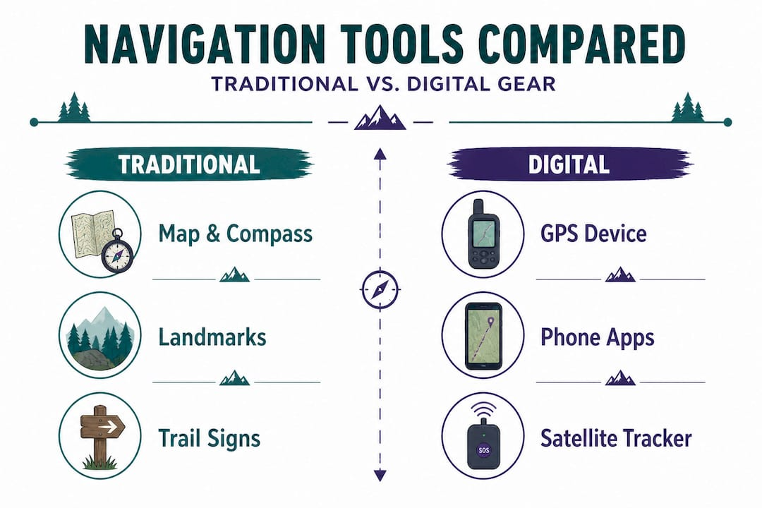
Navigation errors are especially common when adventurers rely solely on GPS or neglect terrain awareness entirely. The pattern shows up consistently in rescue data: someone trusted one tool, that tool failed, and they had no fallback.
Here's how the scenarios play out in real life:
- A dense forest canopy blocks satellite signals. A compass and map keep you on course where GPS can't.
- Heavy rain soaks your paper map into mush. A waterproofed map case or a GPS device saves the day.
- Your phone dies at mile eight of a twelve-mile loop. A compass bearing and terrain knowledge get you out.
- Whiteout snow conditions remove all visible landmarks. A GPS waypoint you set at the trailhead is the only reliable guide home.
Using traditional maps alongside digital GPS navigation isn't redundant, it's smart. Professionals in search and rescue, military navigation, and wilderness medicine all train this way because they know the cost of relying on one method.
Pro Tip: Before any trip, mark three to five key waypoints on both your GPS device and your paper map. Trailhead, water sources, campsite, high point, and exit. If one method fails, you can always cross-reference with the other.
With a toolkit of core skills and a level-headed approach to tools, you're ready to put wilderness navigation into action.
Applying navigation skills: Real-world scenarios and tips
Knowing the theory is great. Using it under pressure is what actually keeps you safe. Let's walk through how these skills play out when it matters most.
Scenario: Off-trail detour. You're hiking a ridge route when a washed-out section forces you to drop off the trail. You move downhill to avoid the hazard, but after twenty minutes, you're not sure which direction the trail is. Here's the correct sequence: stop moving immediately, pull out your map, identify your last known position, take a compass bearing toward where the trail should be, and walk that bearing while watching the terrain for confirming features like a stream crossing or a distinct rock formation you saw earlier.
Best practices every beginner should carry into the field:
- Always tell someone your route and expected return time before you leave
- Download offline maps before entering areas with no cell coverage
- Set a turnaround time and stick to it regardless of how close the summit looks
- Check your position on the map every 20 to 30 minutes, not just when you feel uncertain
- Learn to recognize warning signs of disorientation: walking in circles, losing track of time, or feeling like familiar terrain looks strange
The numbers back this up. Navigation mistakes cause 18% of lost-hiker rescues in Olympic National Park, and up to 30 to 45% of mountain accidents in Japan directly result from getting lost. Critically, 25% of Adirondack lost-hiker incidents involve people carrying no map or GPS at all. The good news is that roughly 75% of lost hikers are found within 24 hours when they stay calm and stay put. That outcome depends on making smart decisions in the first minutes after realizing you're turned around.
For additional real-world planning advice, outdoor adventure planning resources offer solid frameworks for thinking through routes before you ever leave the trailhead.
Understanding how to handle real-world navigation challenges brings us full circle. Here's what most guides miss about mastering these skills.
The overlooked truth about wilderness navigation mastery
Most people focus on gear when they think about navigation. They buy a quality GPS device, download a great trail app, and feel ready. We get it. Good gear matters, and we're a gear brand. But here's the honest truth: the gear doesn't save you. The habit does.
Expert navigators prioritize staying found through constant terrain reading over any tool. That means checking your map before you feel lost, not after. It means glancing at your compass bearing every ten minutes as a routine, not just when something feels off. It means knowing what the ridgeline behind you should look like when you turn around to retrace.
The mental habit is the skill. Tools just make that habit more precise.
We've seen hikers with top-of-the-line GPS units get completely turned around because they looked at the device only when they were already confused. And we've seen budget-compass-and-paper-map hikers navigate flawlessly through genuinely complex terrain because they never stopped paying attention. The difference wasn't the gear. It was the mindset.
Every trip, even a familiar one, is a training opportunity. Practice reading terrain before you need it. Build your own mental checkpoints: "Every time I reach a high point, I'll orient my map." Small routines like this become automatic, and automatic is exactly what you need when things get stressful.
The resources at basic outdoor survival steps go deeper on the mindset side of outdoor preparedness, which pairs directly with the navigation skills covered here.
Equip yourself for confident wilderness navigation
You've now got a real understanding of what wilderness navigation requires, from reading terrain and using a compass to knowing when to trust your GPS and when to trust your gut. The next step is making sure your gear matches your skill level.
At Life Camp Adventure, we build our product line around the idea that skills and equipment should work together. A compass is only as good as the hand holding it, but a quality compass held by a trained navigator is an incredibly powerful tool. Browse our outdoor survival steps guide for a full breakdown of what every outdoor adventurer should know before heading out. When you're ready to build your kit, our essential camping gear collection covers navigation tools, safety essentials, and trip-ready equipment. Not sure where to start? Our guide on how to choose the right equipment will point you in the right direction.
Frequently asked questions
What is the first step in learning wilderness navigation?
Start by learning how to read the terrain and your surroundings before picking up any tools. Practice sequentially: terrain awareness first, then compass and map skills, and GPS last.
How common is getting lost while hiking?
It's more common than most people expect. Navigation errors cause 18% of lost-hiker rescues in Olympic National Park, and between 30 and 45% of mountain accidents in Japan involve getting lost.
Is GPS alone reliable for wilderness travel?
No. Devices can fail in remote areas due to battery drain, poor satellite coverage, or canyon interference, so always carry a map and compass as a backup.
What should I do if I realize I'm lost?
Stop moving immediately. Stay where you are, review your map and last known route, and try to retrace your steps using visible landmarks rather than guessing your way forward.
Are navigation skills needed only for remote wilderness?
Not at all. These skills are valuable in any unfamiliar terrain, including areas just off the trail near popular campsites. Wilderness navigation is essential for safe backcountry travel even where trails do exist.
