TL;DR:
- Map reading is a vital navigation skill that remains reliable when GPS fails due to weather or technical issues. Practicing map skills enhances spatial thinking, increases cognitive flexibility, and builds better situational awareness for outdoor safety. Carrying waterproof maps and mastering terrain association ensures confidence and resilience in any terrain or weather conditions.
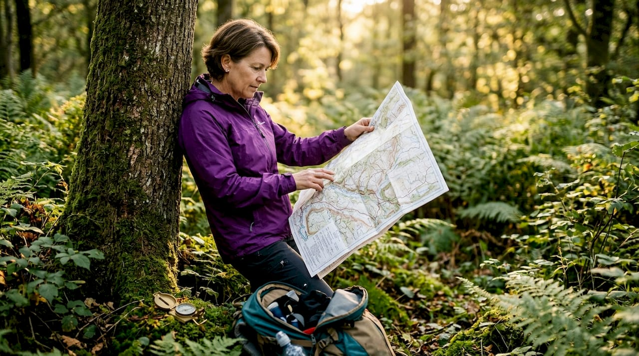
Map reading is the foundational navigation skill that lets you move confidently through any terrain without relying on batteries, signals, or screens. The U.S. Army's FM 3-25.26 manual designates it a zero-fail skill because GPS can be jammed, drained, or blocked by canyon walls. For hikers, backpackers, and survival-minded adventurers, that same logic applies every time you step off a marked trail. Practicing map reading builds the spatial awareness and terrain judgment that no app can replicate.
Why practice map reading for outdoor safety?
Map reading gives you a navigation system that cannot crash. Common GPS failures include dead batteries, no signal in deep valleys, and poor screen visibility in bright sunlight or rain. A paper map has none of those failure modes. It works at minus 20°F, at 12,000 feet elevation, and in a canyon with zero cell coverage.
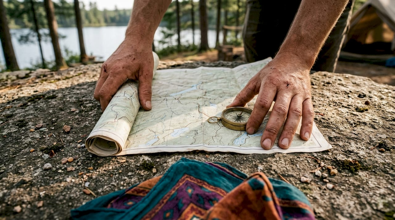
The key to making paper maps reliable in the field is protecting them. Waterproof map cases cost under $15 and keep your map readable through downpours, river crossings, and heavy condensation. That is a low investment for a piece of gear that could save your life.
Beyond weather protection, maps give you terrain comprehension that GPS screens rarely provide. Topographic maps display terrain through contour lines that reveal steepness, elevation gain, cliff faces, and drainage patterns. A GPS arrow tells you which direction to walk. A topo map tells you what you will face when you get there.
- Dead batteries are the most common GPS failure in cold weather
- Signal loss in deep valleys and slot canyons is frequent and unpredictable
- Cracked or fogged screens make GPS unreadable in wet or bright conditions
- Paper maps require no power source and function in any weather
Pro Tip: Carry a waterproof map case alongside your GPS device on every trip. Treat the map as your primary tool and the GPS as a convenient supplement, not the other way around.
How does map reading practice improve your brain?
Map reading builds a specific type of spatial thinking called allocentric navigation. This means you build a mental model of the terrain around you, not just a line from point A to point B. Research from University College London links this type of navigation with increased gray matter density in the hippocampus, the brain region responsible for spatial memory and learning.
GPS navigation works differently. It uses egocentric navigation, where you follow a moving arrow relative to your own position. That approach requires almost no spatial reasoning. Over time, heavy GPS reliance reduces the brain's demand for the hippocampal processing that map reading actively trains.
"Map reading develops a unique cognitive flexibility, allowing people to manage spatial ambiguity and complexity far better than those who depend on GPS-based egocentric navigation. The skill builds tolerance for uncertainty that transfers well beyond the trail."
The cognitive benefits extend past the outdoors. Map skills support fields like urban planning and emergency management by developing critical spatial thinking. Practicing with a topo map regularly sharpens your ability to visualize systems, anticipate obstacles, and make decisions with incomplete information.
- Allocentric navigation builds a full mental map of the environment
- Egocentric GPS navigation requires minimal spatial reasoning from the brain
- Regular map reading increases hippocampal gray matter density over time
- Spatial thinking from map practice transfers to problem-solving in other fields
What essential map reading skills should you practice regularly?
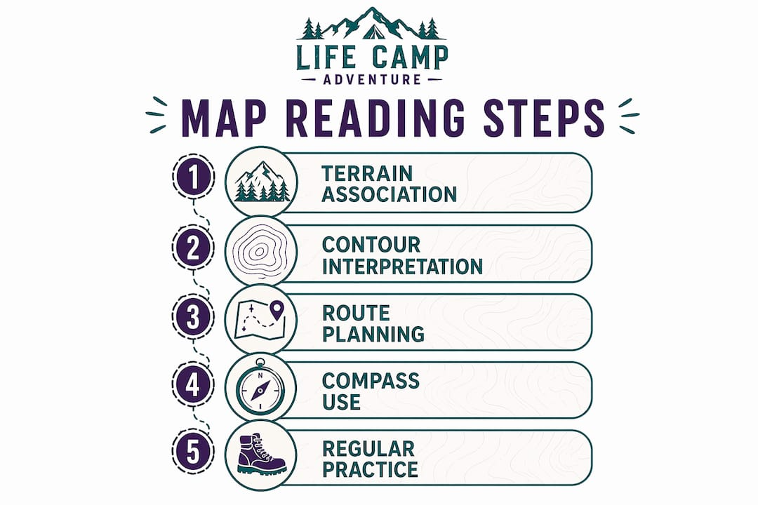
Terrain association is the most practical skill to develop first. It means matching what you see on the map to what you see on the ground. Terrain association is a core technique in military land navigation because it allows strategic route selection for both safety and efficiency. When you can look at a ridgeline and find it instantly on your topo map, you always know where you are.
- Read contour lines. Closely spaced contour lines mean steep terrain. Widely spaced lines mean gentle slopes. V-shaped contours pointing uphill indicate valleys. V-shapes pointing downhill indicate ridges.
- Orient your map with landmarks. Rotate the map until the features on paper align with what you see in front of you. Never navigate with a map held in a fixed position.
- Use compass bearings. Take a bearing to a visible landmark, find it on the map, and confirm your position. Triangulate from two landmarks for a precise fix.
- Apply timing and pacing. Timing and pacing means knowing your walking speed and using the map scale to estimate when a landmark should appear. If it does not appear on schedule, stop and reassess before you drift further off course.
- Use the 30-second rule. At every trail junction or viewpoint, stop and orient your map using at least two visible landmarks. This 30-second habit prevents the slow positional drift that causes most backcountry navigation errors.
Pro Tip: Practice contour line reading at home before your next trip. Print a topo map of a familiar area and try to predict what the terrain looks like from the lines alone. Then go walk it and compare your prediction to reality.
| Skill | When to use it | What it prevents |
|---|---|---|
| Terrain association | Continuously while moving | Getting lost in featureless terrain |
| Compass triangulation | When landmarks are visible | Positional uncertainty |
| Timing and pacing | On long legs between landmarks | Navigation drift |
| 30-second rule | At every junction or viewpoint | Compounding directional errors |
How does map reading complement digital navigation tools?
Map reading is not a replacement for GPS. The combination of a paper map and compass creates a fail-safe system that stays functional when digital technology fails. The goal is a layered navigation system where each tool covers the weaknesses of the other.GPS apps excel at real-time position tracking and route logging. Paper maps excel at terrain comprehension, weather resistance, and zero-power reliability. Using both together gives you the speed of digital navigation and the resilience of traditional skills. Wilderness navigation experts consistently recommend carrying both on any trip beyond a well-marked day hike.
Map reading also makes you a better GPS user. When you understand contour lines and terrain features, you can read a digital topo layer on a GPS app with far more insight. You stop following the arrow blindly and start making informed decisions about route alternatives, bail-out options, and hazard avoidance.
- Use GPS for real-time tracking and distance logging
- Use paper maps for terrain comprehension and route planning
- Download offline digital maps as a middle-ground backup
- Always carry a baseplate compass as the final backup when both screens fail
Key Takeaways
Map reading is the most reliable navigation skill an outdoor adventurer can develop because it functions independently of technology, builds spatial intelligence, and directly improves safety in the field.
| Point | Details |
|---|---|
| Technology-independent reliability | Paper maps work in any weather, at any elevation, and with zero power required. |
| Brain health benefits | Allocentric map reading increases hippocampal gray matter and builds cognitive flexibility. |
| Core skills to practice | Terrain association, compass triangulation, timing and pacing, and the 30-second rule. |
| Layered navigation system | Combine paper maps and compass with GPS apps for maximum safety and redundancy. |
| Low-cost gear investment | A waterproof map case under $15 protects your map and completes your navigation kit. |
Map reading changed how I see every trail I walk
I learned map reading the hard way. Years ago, I was three miles into a solo ridge hike when my GPS battery died in cold weather. I had a paper map in my pack but had never seriously practiced reading it. I spent 40 minutes standing on a ridgeline trying to match what I saw to what was on paper. I got out fine, but I was humbled.
After that trip, I committed to practicing with a topo map before every outing. Not just glancing at it, but actually reading contour lines, identifying drainages, and predicting what the terrain would look like before I arrived. Within a few months, something shifted. I stopped feeling anxious about navigation and started feeling genuinely confident. The map became a story I could read, not a puzzle I had to solve under pressure.
The thing most people miss is that map reading builds situational awareness that GPS simply cannot. When you know the terrain from the map, you notice when something does not match. That mismatch is your early warning system. GPS just tells you to keep walking.
My honest advice: spend 15 minutes with a topo map before your next hike. Not to plan the perfect route, but to read the land. Find the ridges, the valleys, the steep faces. Then go walk it and see how well your mental model matched reality. Do that a dozen times and you will never feel lost again.
— Billy
Gear up for confident navigation with Lifecampadventure
Every adventurer who takes map reading seriously needs the right gear to back it up.
Lifecampadventure carries the survival essentials that complete a solid navigation kit, from waterproof map cases and baseplate compasses to durable packs built for long days in the field. Every piece is selected for reliability in real conditions, not just good looks on a shelf. If you are building out your outdoor kit for 2026, the essential gear guide at Lifecampadventure covers the tools that matter most for safe, confident exploration. Gear that works when conditions get hard is the only kind worth carrying.
FAQ
Why is map reading considered a zero-fail skill?
The U.S. Army's FM 3-25.26 manual designates map reading a zero-fail skill because GPS devices are vulnerable to jamming, battery failure, and signal loss. A paper map and compass work in every condition where a soldier or hiker needs to navigate.
What cognitive benefits does map reading provide?
Map reading uses allocentric navigation, which research from University College London links to increased gray matter density in the hippocampus. This builds spatial memory, cognitive flexibility, and a higher tolerance for ambiguity compared to GPS-only navigation.
How often should you practice map reading skills?
Practice map reading on every outdoor trip, even short day hikes where you also carry a GPS. Regular use of terrain association and the 30-second rule builds the muscle memory that makes the skill reliable under pressure.
What is the 30-second rule in map reading?
The 30-second rule means stopping at every trail junction or viewpoint to orient your map using at least two visible landmarks. This brief habit prevents the slow positional drift that causes most backcountry navigation errors.
Do I need special gear to practice map reading?
A topographic map of your hiking area and a baseplate compass are the two core tools. A waterproof map case, available for under $15, protects your map in wet conditions and completes a reliable, low-cost navigation kit.
