TL;DR:
- Navigation tools allow outdoor enthusiasts to determine their position and plan routes safely through unfamiliar terrain. Combining traditional map and compass skills with digital GPS devices enhances reliability and reduces navigational errors. Practicing these skills and understanding tool limitations are essential for outdoor safety and confidence.
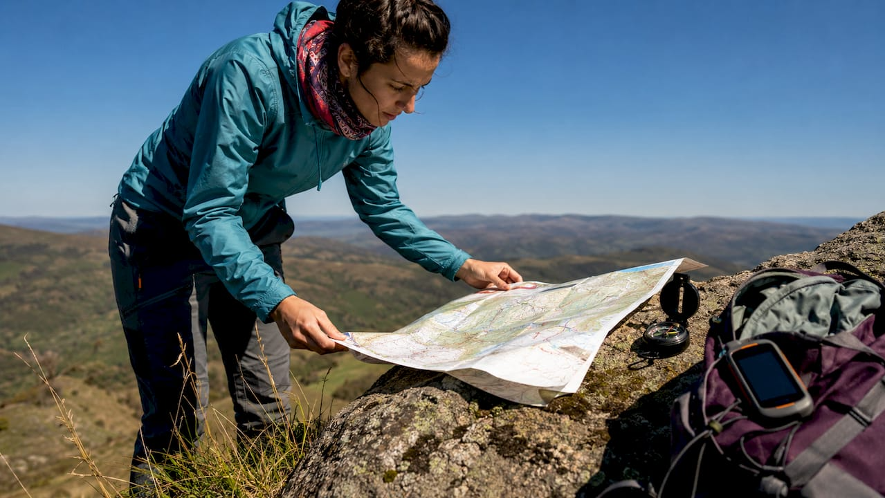
Navigation tools are devices and systems that help you determine your position, plan your route, and move confidently through unfamiliar terrain. Whether you carry a magnetic compass on a mountain trail or rely on a GPS unit through dense forest, the role of navigation tools is to keep you oriented, safe, and in control. For outdoor enthusiasts and travelers, that function is not optional. It is the difference between a successful trip and a dangerous one.
What are the main types of navigation tools and how do they work together?
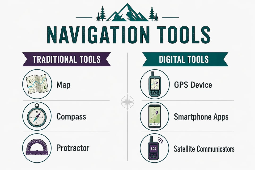
Navigation tools fall into two broad categories: traditional analog instruments and modern digital systems. Understanding both, and knowing when to use each, is the foundation of solid backcountry navigation skills.
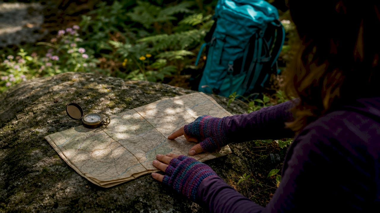
Traditional tools include paper topographic maps, magnetic compasses, and protractors for measuring bearings. These instruments require no power source and no signal. Analog tools require zero batteries and no network connectivity, which makes them the most reliable backup you can carry. A compass does not care about cloud cover, canyon walls, or a dead phone battery.
Digital tools include dedicated GPS receivers like the Garmin inReach series, smartphone apps like Gaia GPS and AllTrails, and the broader network of Global Navigation Satellite Systems. GNSS receivers determine location within a few meters, giving you pinpoint accuracy that a paper map alone cannot provide. Modern apps also offer real-time guidance and offline support, so you can download trail maps before you lose cell service.
The real power comes from using both categories together. Multiple navigation methods used together allow cross-verification, reducing the risk of navigational errors and improving your situational awareness. If your GPS shows you on one ridge but your map and compass suggest another, you have a conflict worth investigating before you take another step.
| Tool | Strengths | Limitations |
|---|---|---|
| Paper topographic map | No power needed, full terrain overview | Requires map-reading skill, can get wet |
| Magnetic compass | Reliable in any conditions, lightweight | No position data, requires map to be useful |
| GPS device (e.g., Garmin inReach) | Precise location, track recording | Battery dependent, signal can fail in canyons |
| Smartphone app (e.g., Gaia GPS) | Offline maps, route planning, lightweight | Battery drain, fragile hardware |
| GNSS network | Global coverage, free for civilian use | Infrastructure dependent, not user-controlled |
Pro Tip: Download offline maps for your entire route before leaving home. Apps like Gaia GPS and AllTrails let you cache detailed trail data so you have full map access even in areas with zero cell coverage.
Why does navigation confidence matter for outdoor safety?
Navigation confidence is your ability to read your environment, interpret your tools, and make sound route decisions under pressure. It is a skill built over time, and it matters more than the quality of any single device you carry.
The risk of depending entirely on digital tools is well documented. Overreliance on GPS can cause spatial deskilling, a measurable reduction in your ability to build mental maps and recognize landmarks. Passive GPS users, those who simply follow turn-by-turn arrows without engaging with the terrain, lose environmental awareness faster than those who actively cross-reference their position with physical features. That loss becomes dangerous when the device fails.
Map literacy is the antidote. When you can read contour lines, identify ridgelines, and estimate distances on a topographic map, you carry a mental model of the terrain that no battery can drain. Using landmark-based navigation instructions actively enhances spatial learning and prevents the cognitive degradation that turn-by-turn GPS directions can cause. The hiker who says "I'll follow the creek north until I hit the saddle" is building a skill. The one who says "I'll follow the blue arrow" is not.
Here are the habits that build genuine navigation confidence over time:
- Practice compass bearings on familiar trails before you need them in the field
- Read a topographic map before every trip and visualize the terrain in three dimensions
- Identify three to five landmarks at the trailhead and track them as you move
- Turn off GPS guidance occasionally and navigate by map alone for short segments
- Debrief after each trip: where did you feel uncertain, and why?
Pro Tip: Take a wilderness navigation course through organizations like the National Outdoor Leadership School (NOLS) or REI Co-op. One weekend of hands-on instruction compresses years of trial-and-error learning.
What are the common limitations of navigation tools?
Every navigation tool has failure modes. Knowing them in advance lets you plan around them rather than discover them mid-trail.
GPS battery drain. A dedicated GPS unit like the Garmin eTrex series lasts 25 hours on two AA batteries. A smartphone running Gaia GPS with the screen on drains in four to six hours. Cold temperatures accelerate battery loss significantly. Always carry spare batteries or a charged power bank.
Signal loss in technical terrain. Deep canyons, dense forest canopy, and steep cliff faces can block satellite signals. Signal loss and device malfunctions are common risks in remote areas, and they tend to happen exactly when you need guidance most.
Outdated or cached maps. Cached maps in navigation apps reduce accuracy in remote areas because trail reroutes, new hazards, and seasonal closures may not appear. Always check for map updates before departure and cross-reference with a current paper topo.
Compass user error. A compass is only as accurate as the person using it. Declination adjustment, holding the compass level, and avoiding metal objects near the needle are all sources of error for beginners. Practice eliminates most of these mistakes, but they are real risks for first-time users.
Map misinterpretation. Reading contour lines incorrectly can lead you toward a cliff face you thought was a gentle slope. Topographic literacy takes time to develop. Start with simple terrain and build complexity gradually.
Overconfidence in a single source. Treating any one tool as infallible is the most dangerous limitation of all. Map and compass remain reliable where GPS fails, and GPS provides precision that a map alone cannot match. Neither is complete without the other.
The mitigation strategy is straightforward: carry at least two independent navigation methods, keep analog tools charged (they need no charging), and verify your position using multiple data sources whenever you feel uncertain.
How to use navigation tools effectively in real-world outdoor exploration
Effective navigation is a process that starts before you leave the trailhead and continues until you return. Here is how to apply your tools at each stage.
Pre-trip route planning. Study your route on both a digital platform and a paper topo map. Apps like Gaia GPS and CalTopo let you measure elevation gain, identify water sources, and mark waypoints. Print or download the paper map as a backup. Note the UTM grid coordinates of your destination and key waypoints.
Trailhead orientation. Before you start walking, orient your map to the terrain. Identify the direction of travel, the first major landmark, and the general shape of the terrain ahead. Set a waypoint on your GPS at the trailhead so you always have a return reference.
Moving navigation. Check your GPS position every 20 to 30 minutes rather than staring at it constantly. Use the time between checks to observe the terrain, match what you see to your map, and build your mental picture of the route. This is the active engagement that prevents spatial deskilling.
Cross-verification at decision points. At every trail junction, ridge crossing, or river ford, confirm your position on both your GPS and your map before proceeding. This takes 90 seconds and eliminates most navigational errors.
Emergency navigation. If your GPS fails, use your compass to shoot a bearing to a known landmark and triangulate your position on the map. If you have no compass, use the sun: it rises in the east and sets in the west, giving you a rough cardinal reference. The importance of navigation tools for camping safety extends to knowing these fallback techniques before you need them.
Device maintenance. Clean GPS contacts after wet trips, store batteries at room temperature, and update firmware and maps before each season. A well-maintained device is a reliable device.
Pro Tip: Mark your campsite as a GPS waypoint every time you set up. If you get turned around during a day hike, that single waypoint gives you an unambiguous target to navigate back to.
Key takeaways
Reliable outdoor navigation requires combining traditional and digital tools, because no single method covers every failure scenario.
| Point | Details |
|---|---|
| Use both analog and digital tools | A map and compass back up GPS when batteries die or signals fail. |
| Build navigation confidence actively | Practice compass bearings and map reading on familiar terrain before remote trips. |
| Know your tool's failure modes | GPS loses signal in canyons; cached maps go stale; compasses need declination adjustment. |
| Cross-verify at every decision point | Confirm position on GPS and map at junctions to eliminate most navigational errors. |
| Pre-trip planning is non-negotiable | Download offline maps, print a paper topo, and mark key waypoints before you leave home. |
Why I think most hikers are one dead battery away from trouble
I have watched experienced hikers freeze at a trail junction because their phone died and they had never looked at the paper map in their pack. The map was there. The skill was not. That gap is the real navigation problem in 2026, not the quality of the tools.
Digital tools like Garmin inReach and Gaia GPS are genuinely impressive. Navigation tools are evolving into travel companions that facilitate dynamic exploration, and I use them on every trip. But I also think the outdoor community has developed an unhealthy dependency on screens. When the screen goes dark, too many people have nothing left.
The cognitive impact of GPS use varies widely between expert and passive users. Expert users treat GPS as an augmentation layer on top of existing spatial skills. Passive users treat it as a replacement for those skills. The difference shows up the moment something goes wrong.
My honest recommendation: spend one trip per season navigating entirely by map and compass. Not because GPS is bad, but because the practice keeps your spatial cognition sharp and your confidence grounded in something that cannot run out of power. The best navigation system you own is the one between your ears, and it needs training just like any other skill.
— Billy
Gear up for your next adventure with Lifecampadventure
Knowing your tools is half the equation. Having reliable gear is the other half. Lifecampadventure carries the essential camping gear every outdoor traveler needs, from navigation devices and compasses to maps, survival essentials, and trail-ready equipment built to perform when conditions get tough. Every product in our catalog is selected for durability, ease of use, and real-world performance. Before your next trip into the backcountry, check our outdoor survival checklist to make sure you have everything you need to stay safe, oriented, and confident on the trail.
FAQ
What is the role of navigation tools in outdoor exploration?
Navigation tools help you determine your position, plan your route, and move safely through unfamiliar terrain. Their core function is to prevent disorientation and support sound decision-making in the field.
What are the best navigation tools for hikers?
The most effective combination for hikers is a dedicated GPS device like the Garmin inReach, a topographic map, and a magnetic compass. Using all three together allows cross-verification and covers the failure modes of each individual tool.
How do GPS navigation systems work?
GPS receivers pick up signals from GNSS satellites to calculate position within a few meters. The system is free for civilian use and maintained at approximately US$750 million per year, though it requires clear sky visibility to function accurately.
What happens when navigation tools fail in the backcountry?
When digital tools fail due to battery drain or signal loss, a paper map and compass become your primary navigation system. Knowing how to take a compass bearing and triangulate your position on a topo map is the skill that keeps a device failure from becoming an emergency.
How can I improve my navigation skills for outdoor travel?
Practice compass bearings and map reading on familiar trails, take a structured course through organizations like NOLS, and deliberately navigate without GPS on short segments to build spatial awareness and wilderness navigation confidence.
