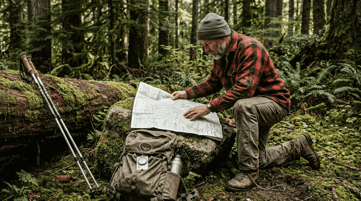
Many outdoor enthusiasts trust GPS devices completely, assuming technology alone will keep them safe on the trail. This overconfidence can lead to dangerous situations when batteries die, signals fade, or devices malfunction in remote terrain. Maps remain an essential navigation tool that provides reliable terrain information, elevation data, and route planning capabilities that GPS simply cannot match. Understanding how to read and use maps effectively transforms your outdoor adventures from risky guesswork into confident exploration. This guide reveals practical map skills that enhance safety, improve decision making, and ensure you stay on course no matter where your adventures take you.
Key takeaways
| Point | Details |
|---|---|
| Maps show critical terrain details | Paper maps reveal elevation changes, hazards, and landscape features that GPS screens often miss or oversimplify. |
| Scale mastery enables accurate planning | Understanding map scales like 1:24,000 helps you estimate real distances and plan realistic travel times. |
| Compass integration ensures reliability | Combining maps with compass skills creates a backup navigation system that works without batteries or signals. |
| Terrain knowledge improves safety | Reading contour lines and topographic features helps you avoid steep slopes, identify water sources, and choose safer routes. |
Why maps remain essential in outdoor navigation
GPS technology has revolutionized how we explore the outdoors, but relying solely on electronic devices creates dangerous vulnerabilities. Batteries drain faster in cold weather, signals disappear in deep canyons, and screens crack when dropped on rocky terrain. These failures happen precisely when you need navigation most.
Paper maps provide stable, detailed information that remains accessible regardless of weather, temperature, or technical malfunctions. They display comprehensive terrain features, elevation patterns, water sources, and potential hazards across large areas simultaneously. This big picture perspective helps you understand your position within the broader landscape, something a small GPS screen struggles to convey effectively.
The combination of paper maps and compass serves as your ultimate backup navigation method. When technology fails miles from civilization, these traditional tools become lifelines. Research shows that outdoor adventurers who carry both digital and analog navigation tools experience significantly fewer incidents of getting lost compared to those relying on GPS alone.
Understanding your map transforms it from a piece of paper into a detailed conversation with the landscape, revealing stories about terrain, water flow, and safe passage that no GPS screen can tell.
Consider the practical advantages maps offer:
- No battery anxiety or charging requirements during multi-day trips
- Waterproof and tear-resistant versions withstand harsh conditions
- Larger viewing area shows context and alternate routes simultaneously
- No learning curve for basic reading after initial skill development
- Reliable performance in areas with dense tree cover or steep terrain
Integrating maps into your outdoor navigation camping safety routine creates redundancy that could save your life. Smart adventurers treat GPS as a convenient primary tool while keeping map skills sharp for when electronics inevitably fail. This balanced approach combines modern convenience with time-tested reliability, ensuring you can navigate confidently through any challenge the wilderness presents. Understanding the role of GPS outdoor adventure helps you appreciate why maps complement rather than compete with technology.
Understanding map scales and topographic features
Map scales define the mathematical relationship between distances on paper and actual ground distances. A scale of 1:24,000 means one inch on your map represents 24,000 inches or 2,000 feet in reality. Common topographic map scales include 1:24,000 for detailed terrain and 1:50,000 for broader area coverage.
Accurate distance estimation depends entirely on understanding your map's scale. Calculate real-world distances by measuring map distances with a ruler, then multiplying by the scale ratio. For instance, three inches on a 1:24,000 map equals 6,000 feet or roughly 1.14 miles of actual hiking distance. This precision helps you plan realistic daily mileage and estimate arrival times at campsites or water sources.
Pro Tip: Carry a small ruler or map protractor in your navigation kit for precise distance measurements. Mark common distances like one mile directly on the ruler edge matching your map scale for quick reference without calculations.
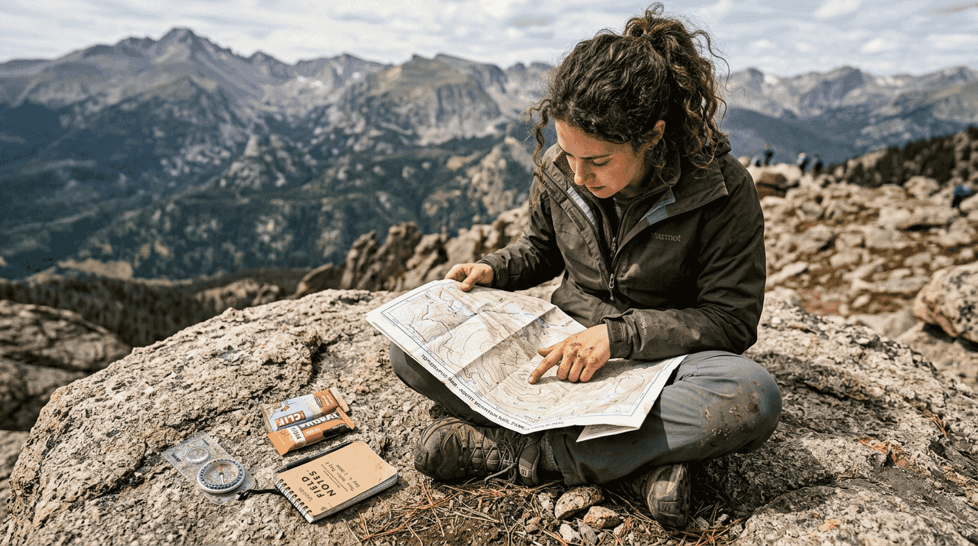
Topographic maps use contour lines to show elevation changes and terrain shape. Each line connects points of equal elevation, creating a visual representation of the landscape's three-dimensional form. Lines spaced close together indicate steep slopes, while widely spaced lines show gentle terrain. This information proves critical when selecting routes that match your fitness level and avoiding dangerous cliff areas.
| Map Scale | 1 Inch Equals | Best Use Case |
|---|---|---|
| 1:24,000 | 2,000 feet | Detailed hiking and route planning |
| 1:50,000 | 4,167 feet | General backcountry navigation |
| 1:100,000 | 8,333 feet | Broad area overview and long-distance planning |
Index contours appear as darker, thicker lines labeled with specific elevations, typically every fifth contour line. The contour interval, printed in the map legend, tells you the vertical distance between adjacent lines. A 40-foot contour interval means each line represents a 40-foot elevation change. Visualizing terrain becomes intuitive once you recognize these patterns.
Key topographic features to identify-V-shaped contours pointing uphill indicate valleys or stream drainages
- V-shaped contours pointing downhill show ridges or spurs
- Concentric circles with higher elevations inside represent peaks or hills
- Concentric circles with lower elevations inside indicate depressions or sinkholes
- Contour lines crossing streams always point upstream
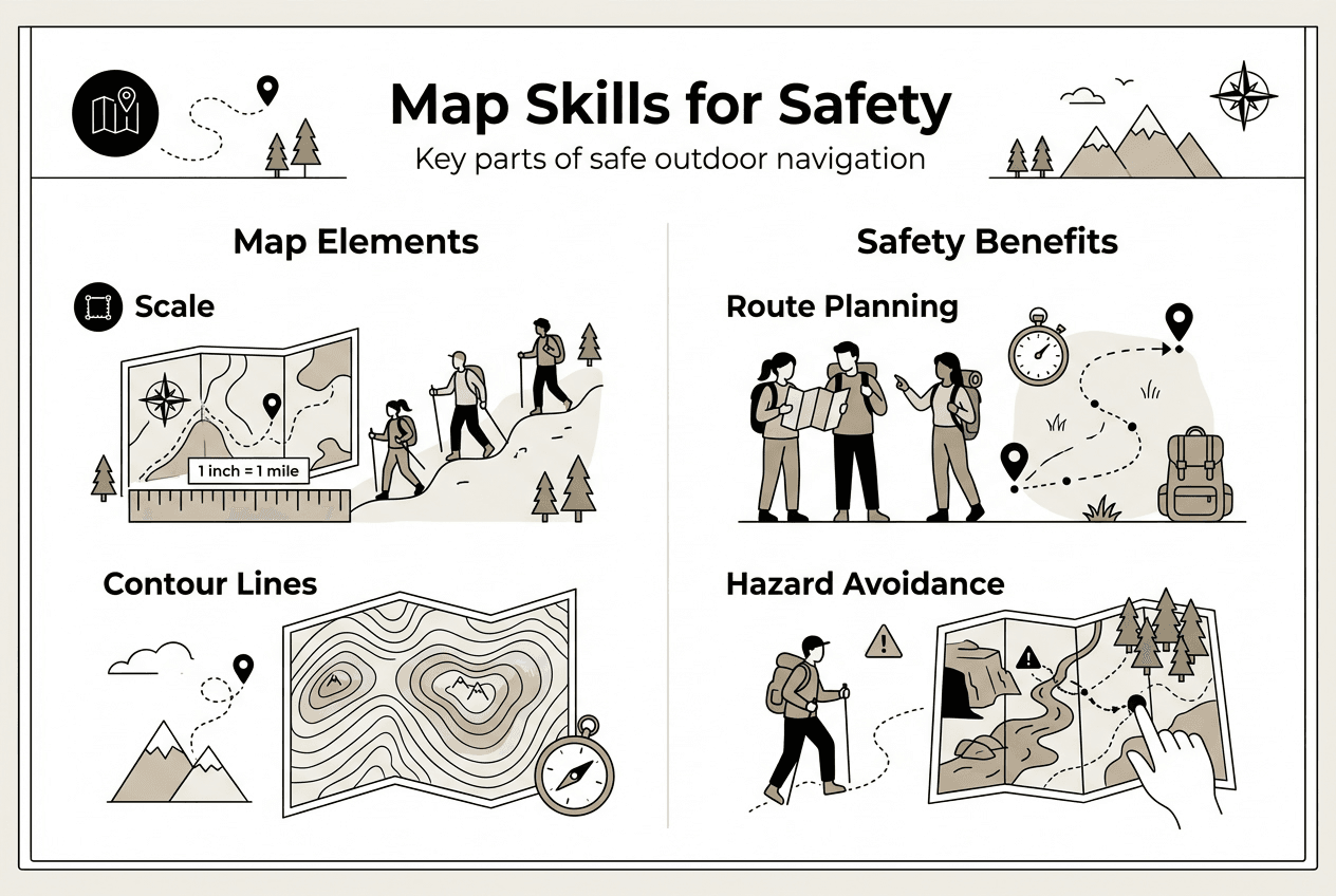
Mastering these map elements transforms abstract lines into vivid mental images of the terrain ahead. You can anticipate steep climbs, identify potential viewpoints, locate water sources in valleys, and choose routes that avoid exhausting elevation gain. This knowledge directly enhances your outdoor adventures benefits by enabling smarter, safer route choices that match your capabilities and goals.
Combining maps and compass for confident navigation
Effective navigation requires integrating your map with compass skills to maintain accurate bearings across varied terrain. The process begins by orienting your map to match the actual landscape. Place your compass on the map with the direction-of-travel arrow pointing toward your destination, then rotate the map and compass together until the magnetic needle aligns with north on the map.
Magnetic declination presents a critical challenge because compass needles point toward magnetic north, not true north shown on maps. This difference varies by location, ranging from zero to over 20 degrees in some regions. Failing to adjust for declination causes navigation errors that compound over distance, potentially leading you miles off course. Check your map's declination diagram and adjust your compass accordingly before taking any bearings.
Follow these steps for accurate map and compass navigation:
- Identify your current position and destination on the map using terrain features and landmarks
- Place the compass edge connecting these two points with the direction-of-travel arrow pointing toward your destination
- Rotate the compass housing until the orienting lines align with the map's north-south grid lines
- Remove the compass from the map and adjust for magnetic declination per your map's specifications
- Hold the compass level at chest height and rotate your body until the magnetic needle aligns with the orienting arrow
- Follow the direction-of-travel arrow, maintaining this bearing as you move
Lateral drift poses a significant challenge even for experienced navigators. Humans naturally deviate from straight paths when walking through featureless terrain without visual reference points. This unconscious wandering can lead you in circles despite your best intentions to travel straight. Regular compass checks every few minutes keep you on course and prevent this common navigation error.
Pro Tip: Select prominent landmarks along your bearing line before you start walking. Check your compass bearing against these landmarks every 5-10 minutes to catch drift early. If the landmark shifts position relative to your bearing, correct your course immediately.
Combining map and compass skills builds genuine self-reliance in remote areas where help may be hours or days away. These techniques integrate seamlessly with outdoor survival basics and complement first aid outdoors knowledge to create comprehensive backcountry competence. Practice these skills regularly in familiar areas before testing them in challenging wilderness environments. Confidence comes from repetition and successful experience, not theoretical knowledge alone.
Applying map skills for safer and smarter outdoor adventures
Practical map application transforms navigation from a technical exercise into a strategic advantage that enhances every aspect of your outdoor experience. Understanding topographic features improves hazard recognition and enables you to make informed route choices before committing to difficult terrain. Closely spaced contour lines warn of steep, potentially dangerous slopes that may require technical skills or alternate routes.
Route planning using terrain knowledge helps you identify optimal campsites near water sources while avoiding flood-prone valley bottoms. Maps reveal spring locations, stream crossings, and lake access points that GPS devices often miss or misrepresent. This information proves invaluable when planning daily mileage and rest stops, especially on multi-day trips where water availability determines your camping options.
| Navigation Approach | Advantages | Limitations |
|---|---|---|
| Map-based planning | Shows terrain context, identifies hazards, reveals water sources, enables route alternatives | Requires skill development, needs physical carrying, information may be outdated |
| GPS-only navigation | Provides precise coordinates, shows real-time position, offers digital convenience | Battery dependent, signal unreliable, limited terrain context, screen size restricts view |
Expert guidance emphasizes that reading maps develops your ability to anticipate terrain challenges beyond simply locating yourself. You learn to recognize saddles for easier ridge crossings, identify benches for comfortable camping, and spot potential avalanche terrain to avoid in winter. This predictive capability separates competent navigators from those who merely follow electronic directions without understanding their surroundings.
Practical tips for preparing and using maps effectively:
- Laminate maps or store them in waterproof cases to protect against rain and river crossings
- Mark key waypoints, campsites, and water sources with highlighter before your trip
- Fold maps to show your planned route area, reducing bulk and handling time
- Practice reading terrain features in familiar areas to build pattern recognition skills
- Carry backup map sections covering adjacent areas in case you need alternate routes
- Update old maps with recent trail changes or closures using online resources before trips
Map skills directly increase your confidence when exploring unknown landscapes. Instead of anxiety about getting lost, you develop calm assurance based on your ability to read terrain, maintain bearings, and adapt routes as conditions change. This psychological advantage reduces stress, improves decision making, and allows you to focus on enjoying the adventure rather than worrying about navigation.
Integrating quality gear supports your navigation success. Explore options for choosing camping equipment that complements your map skills, and review outdoor adventure gear reviews to find reliable tools that perform when conditions turn challenging. The combination of solid navigation skills and dependable equipment creates the foundation for safe, enjoyable outdoor experiences that push your boundaries without crossing into reckless territory.
Equip yourself for successful outdoor exploration
Developing strong map navigation skills represents only part of outdoor preparedness. Choosing camping equipment that matches your adventure style ensures comfort and safety throughout your journey. Quality gear performs reliably when weather deteriorates, temperatures drop, or unexpected challenges arise miles from civilization.
Explore comprehensive reviews covering tents, sleeping systems, cookware, and survival essentials designed for serious outdoor enthusiasts. The best camping gear 2025 comparison helps you evaluate options across price points and use cases, while camping tents comparison guides reveal which shelters deliver the best combination of weight, durability, and weather protection. Pairing navigation competence with reliable equipment creates the complete package for confident wilderness exploration.
Frequently asked questions
When should I use paper maps instead of relying on GPS devices?
Use paper maps as your primary navigation tool in remote areas with unreliable cell coverage or when planning multi-day trips where battery life becomes critical. Maps excel for route planning before trips, providing terrain context that helps you anticipate challenges and identify alternatives. Always carry both paper maps and GPS devices to combine the reliability of analog navigation with the convenience of digital technology. The outdoor navigation camping safety approach emphasizes redundancy over single-method dependence.
What if my GPS fails during a trip? Can I rely solely on my map and compass?
Yes, map and compass provide reliable backup when GPS devices fail or lose signal in remote terrain. These traditional tools work without batteries, signals, or technical dependencies that plague electronic devices. Regular practice ensures you maintain confidence navigating without electronics, turning potential emergencies into manageable situations. Integrate map and compass skills with your outdoor survival basics training to build comprehensive backcountry competence.
Which map features should I learn first to improve my outdoor navigation?
Start by mastering the legend, scale, contour lines, compass rose, and gridlines before attempting complex navigation. These fundamental features help you interpret terrain accurately and understand your orientation relative to the landscape. Focus on recognizing elevation patterns through contour lines, as this skill directly impacts route selection and safety decisions. Building this foundation through outdoor navigation camping safety practice makes advanced techniques easier to learn later.
How can I practice using a map and compass before heading into the wilderness?
Practice map and compass navigation in familiar local parks, trails, or neighborhoods where getting temporarily disoriented carries no serious consequences. Join orienteering clubs or events that provide structured courses with checkpoints to verify your navigation accuracy. Simulate wilderness conditions by navigating without trails or obvious landmarks, using only your map, compass, and terrain features for guidance. This deliberate practice builds muscle memory and confidence that transfers directly to backcountry situations. Combine navigation training with outdoor survival basics to develop comprehensive wilderness skills.
What should I do if I feel lost despite using a map and compass?
Pause immediately and assess your current position using visible terrain features, compass bearings, and map landmarks rather than continuing blindly. Avoid panic by remembering that staying calm improves decision making and conserves energy for problem solving. Retrace your steps to the last confirmed location if safe, or remain in a visible, protected area while reassessing your position. Use emergency communication devices to call for help if you cannot determine your location after careful analysis. Understanding first aid outdoors complements navigation skills by preparing you to handle injuries that may occur if you become disoriented.
Recommended
- Role of GPS in Outdoor Adventure Safety and Success
- Outdoor Navigation – Why It Matters for Camping Safety
- Master essential first aid steps for outdoors safety 2026
- Unlock the benefits of outdoor adventures in 2026
- Hiking Theth to Nderlyse and Back – Peaks of the Balkans
- 7 Must-Know Tips for Exploring Utah Hiking Trails Safely | ReVroom
