TL;DR:
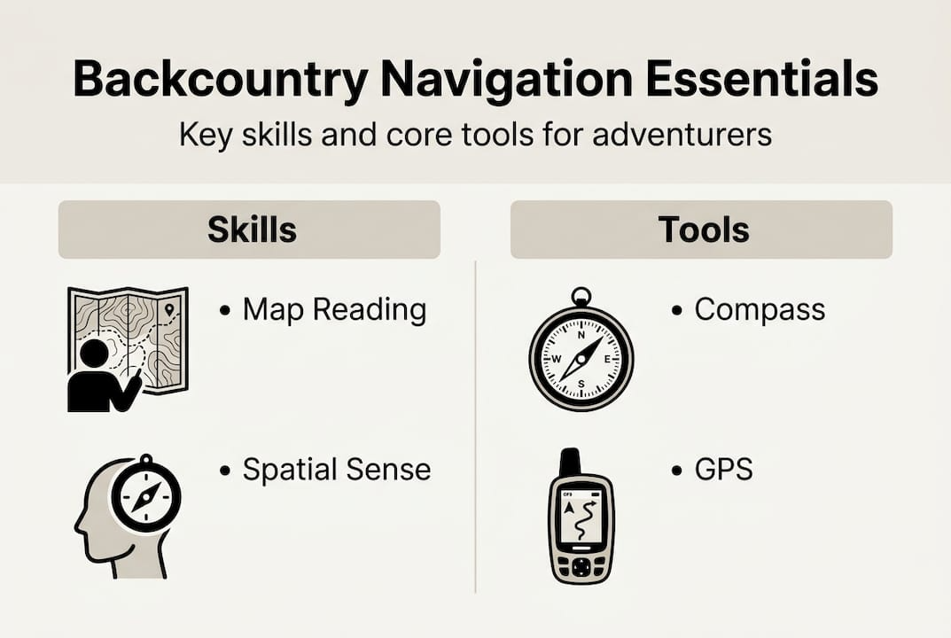
- Backcountry navigation relies on maps, compasses, terrain recognition, and spatial awareness.
- Traditional tools like topographic maps and compasses are essential, with GPS serving as a backup.
- Developing terrain awareness and practicing layered navigation prevent emergencies in remote environments.
You can have the most advanced GPS unit on the market and still get dangerously lost in the backcountry. Sounds unlikely, right? Batteries die. Signals drop. Screens crack. GPS devices are valuable but not foolproof, and adventurers who discover that the hard way often do so miles from the nearest trailhead. Backcountry navigation is a full skill set, not a single device. It blends map reading, compass work, terrain recognition, and spatial awareness into one confident practice. In this guide, we break down what backcountry navigation really means, the tools you need, how to build your instincts, and how to apply everything when it counts most.
Key Takeaways
| Point | Details |
|---|---|
| Map and compass basics | Understanding maps and compasses forms the backbone of safe backcountry navigation. |
| GPS as backup | Always use GPS as an aid, not a primary tool, and prepare for device failures in remote areas. |
| Spatial awareness matters | Reading terrain and locating landmarks is critical for avoiding disorientation in the wilderness. |
| Practice real scenarios | Test navigation skills in practice runs before committing to challenging backcountry trips. |
| Equip for safety | Quality gear, reliable tools, and careful planning ensure safer, more enjoyable adventures. |
Understanding backcountry navigation
Now that we have set the stage, let us clarify what backcountry navigation really means and why it matters.
Backcountry navigation is the practice of using maps, compasses, and terrain recognition to find your way through remote, unmarked, or trail-free wilderness. Unlike frontcountry hiking where signposts, paved paths, and cell coverage guide you, backcountry travel puts you in charge of every directional decision. That is a massive responsibility and an incredible skill.
The differences between frontcountry and backcountry navigation run deeper than just trail markers. Frontcountry settings offer maintained paths, nearby rangers, and reliable infrastructure. Backcountry environments are unpredictable. Terrain shifts quickly. Weather closes in fast. One wrong turn can mean hours of extra travel or a genuine survival situation. A solid backcountry hiking guide will always emphasize navigation as a core safety skill, not an optional extra.
Here is a quick comparison of the two environments:
| Feature | Frontcountry | Backcountry |
|---|---|---|
| Trail markings | Clear and frequent | Rare or nonexistent |
| Cell signal | Usually available | Often absent |
| Rescue access | Fast | Slow or difficult |
| Navigation tools needed | Phone or signage | Map, compass, GPS |
| Skill level required | Basic | Intermediate to advanced |
Why does this matter for you as an outdoor adventurer? Because the gap between a great trip and a dangerous one often comes down to preparation. Knowing the essential outdoor skills before you leave the trailhead gives you options when conditions change.
Core navigation principles every backcountry traveler should know:
- Orient your map to align with the actual landscape before you move
- Track your position continuously, not just when you think you are lost
- Identify escape routes at every stage of your route plan
- Cross-reference at least two tools or landmarks before making a directional decision
- Study the terrain at home before you ever set foot on the trail
Navigation is not just about knowing where you are. It is about knowing where you are going, what is between you and your goal, and what you will do if your plan falls apart.
Core navigation tools and methods
With a clear understanding of backcountry navigation, it is time to explore the essential tools and methods.
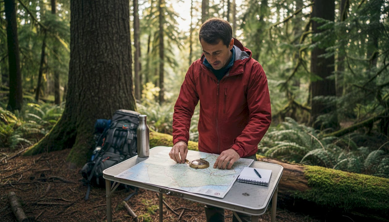
Maps and compasses remain essential even as GPS usage increases, and every experienced backcountry traveler will tell you the same thing. Technology is a layer on top of foundational skills, not a replacement for them.Topographic maps are the gold standard for backcountry navigation. They show elevation changes, water sources, ridgelines, valleys, and terrain features that satellite images often miss. Learning to read contour lines, spot saddles, and identify drainages gives you a picture of the land before you walk through it.
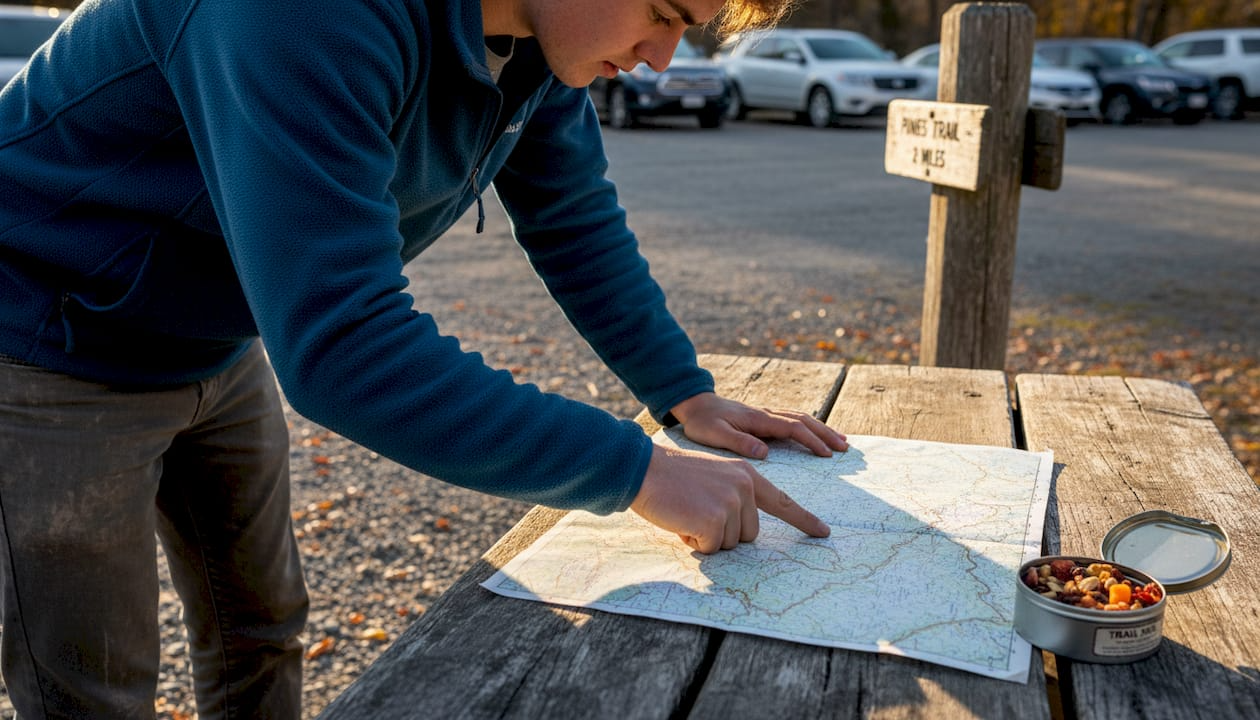
Compasses tell you direction relative to magnetic north, which lets you take bearings, follow a heading, and triangulate your position. A baseplate compass with a rotating bezel is the most practical choice for trail use. Practice taking bearings at home so the motion is natural before you need it under pressure.
GPS devices add precision and speed to your navigation, but using GPS for outdoor safety means understanding its limits too. Signal loss in deep canyons, battery failure in cold temps, and device damage are all real risks.
Here is a side-by-side look at your main tools:
| Tool | Strengths | Weaknesses |
|---|---|---|
| Topographic map | No power needed, full terrain view | Requires skill to read |
| Compass | Reliable, lightweight, always works | Needs map for context |
| GPS device | Precise, fast, route tracking | Battery dependent, signal gaps |
| Phone GPS | Convenient, downloadable maps | Short battery life, fragile |
How to use these tools effectively in the field:
- Download offline maps before you leave cell range
- Set your compass declination to account for the difference between magnetic and true north
- Mark waypoints at trail junctions, water sources, and campsites
- Cross-check your GPS position against your physical map every hour
- Keep your compass and map accessible, not buried in your pack
Pro Tip: Practice using maps in outdoor navigation at a local park before your backcountry trip. Reading terrain in a familiar setting builds the muscle memory you will rely on when the stakes are higher.
Choosing the right setup comes down to your trip length, terrain type, and honest assessment of your skill level. A day hike on a well-documented trail needs less gear than a five-day off-trail expedition. Whatever you carry, always bring at least two navigation methods.
Building spatial awareness and terrain recognition
Beyond tools, the true art of navigation comes from developing a keen sense of the land.
Spatial awareness is vital to avoid disorientation in unfamiliar environments, and it is a skill you can train. Spatial awareness means continuously building a mental map of where you are relative to your surroundings. It is the difference between a hiker who confidently adjusts when a trail disappears and one who panics.
Landmarks are your anchors. Pick natural features you can identify from multiple distances. A distinctive peak, a large rock formation, a river bend, or a ridgeline silhouette all serve as reference points. When you identify three or more landmarks and triangulate between them, your confidence in your position grows sharply. Use your hiking skills guide to practice this on easier terrain first.
Reading terrain means predicting what comes next before you see it. A tightening of contour lines on your map means the slope ahead is steepening. A series of contour lines forming a V shape pointing uphill signals a drainage or creek. These clues help you anticipate obstacles, conserve energy, and choose smarter routes.
"The land always tells you where it is going. Your job is to listen before you move."
Route selection is where planning and real-world observation meet. Before you leave camp, check your hiking preparation guide and ask yourself three questions: What is my primary route? What is my fallback if conditions change? Where are the bailout points if I need to exit early?
Key habits for building terrain awareness on the trail:
- Look back frequently so you recognize the terrain from the return direction
- Note water features since streams and rivers are reliable orientation anchors
- Track elapsed time and distance to estimate how far you have traveled
- Mark mental checkpoints every 20 to 30 minutes to confirm you are on course
A thorough hiking trip planning process pairs perfectly with terrain awareness. When you study the map before departure and then match what you see in the field, your spatial confidence compounds over time.
Applying navigation skills in real-world backcountry scenarios
To bring your skills together, let us see how everything works in real-world backcountry adventures.
Integrating digital and traditional tools is vital for navigating remote areas, and nothing makes that clearer than a realistic scenario on the trail.Picture this: you are two days into a solo backpacking trip. You wake up to heavy fog that cuts visibility to 30 feet. Your GPS shows your position, but landmarks are invisible and the trail ahead vanishes into white. This is where layered navigation saves you.
Here is a step-by-step process for navigating in low visibility or challenging conditions:
- Stop and orient your map to the landscape using your compass before moving
- Identify your last confirmed position and mark it as your reference point
- Set a bearing toward your next waypoint using your compass
- Walk short legs of 50 to 100 meters, confirm position, then continue
- Check your GPS to verify you match your expected position on the topo map
- Look for micro terrain features like slope angle changes or creek crossings that confirm location
When gear malfunctions, stay calm. A dead GPS is frustrating, not catastrophic, if you have a map and compass. When you suspect you have lost your bearing, use navigation for camping safety fundamentals: stop moving, pull out the map, identify the last point you were certain of, and work forward from there.
Pro Tip: Always tell someone your planned route and expected return time before any backcountry trip. If your navigation goes wrong, this single habit dramatically improves your rescue odds.
Common troubleshooting moments every backcountry navigator faces include unexpected trail forks not shown on the map, sudden weather changes that block landmark visibility, and terrain that looks nothing like the map suggests. In each case, the solution is the same: slow down, cross-reference your tools, and trust your preparation.
Why mastering navigation is the ultimate outdoor skill
Before we wrap up, here is an honest perspective every adventurer should hear.
We see a lot of hikers gear up with the latest technology and almost nothing else in the way of actual navigation knowledge. That is a pattern worth pushing back on. A device is only as reliable as its battery, its signal, and the conditions around it. Real navigational confidence comes from understanding the land itself.
When you truly know how to read a map and move through terrain with intention, something shifts. Uncertainty becomes curiosity. Getting slightly off course becomes a problem you solve, not a crisis you survive. That transformation is exactly what separates a nervous adventurer from a skilled one.
We also believe that relying too heavily on GPS for adventure safety creates a false sense of security that can escalate small mistakes into serious emergencies. The best navigation practice blends digital tools with traditional methods, always keeping human judgment at the center. Master the fundamentals first. Let technology amplify what you already know, not replace it.
Enhance your adventures with essential camping gear
With skills in hand, equip yourself with the best tools for safe and memorable journeys.
Strong navigation skills deserve equally reliable gear to back them up. At Life Camp Adventure, we have gathered the resources you need to build a kit that supports every trip, from day hikes to multi-week expeditions.
Explore our camping tents comparison to find shelter that holds up in unpredictable backcountry conditions. Check out our guide on packing survival gear to make sure you are covered when plans change. And if you want to streamline your load without leaving essentials behind, our packing tips for campers will help you pack smart and move fast. Great navigation and great gear work together every time.
Frequently asked questions
What is the most important skill in backcountry navigation?
Maps and compasses are fundamental to navigation, making map reading the essential foundation, but spatial awareness and compass use are equally vital for staying oriented and making sound route decisions.
Can I rely only on GPS for navigation in the backcountry?
GPS devices can fail due to signal loss or battery depletion, so they should always be backed up with a physical map and compass to ensure you have reliable options in any condition.
How do I choose the best navigation tools?
Mixing digital and traditional tools is recommended for reliable navigation, so choose based on your terrain and trip length, and always carry at least two methods regardless of how confident you feel in any single device.
What should I do if I lose my bearings in the wilderness?
Stop moving immediately, pull out your map and compass, and scan for recognizable natural landmarks to re-establish your position before deciding whether to continue forward or retrace your steps to a known point.
